Discover the charm of Copenhagen like a local with our detailed tourist map and insider tips!
Understanding the Tourist Map of Copenhagen
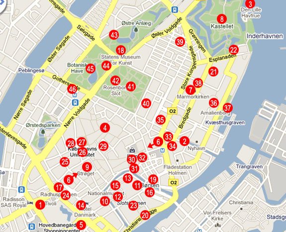
Copenhagen is a city that beautifully blends its rich history with modern-day charm. Navigating its streets may feel daunting initially, but with a reliable tourist map, you can unlock its hidden treasures. During my first visit to the Danish capital, I was amazed at how a well-structured map could transform an ordinary trip into an unforgettable adventure!
Why a Tourist Map is Essential
A tourist map of Copenhagen is more than just a navigation tool; it acts as your personal tour guide. It can help you:
- Identify key attractions and landmarks.
- Locate hidden gems away from the usual tourist path.
- Plan your daily itinerary effectively.
Main Components of a Tourist Map
Typically, a detailed tourist map will include:
- Public transport options (bus, metro, train).
- Popular tourist attractions.
- Restaurants, cafés, and local shops.
- Emergency services and first-aid locations.
Copenhagen’s Must-Visit Attractions
Here’s a handy overview of Copenhagen’s top attractions, all easily accessible through your tourist map:
The Little Mermaid
This iconic statue is a must-see. As I stood by the water, I was struck by both its beauty and its poignant story.
Tivoli Gardens
One of the world’s oldest amusement parks, Tivoli Gardens is a place where the whimsical comes to life. Be sure to check their website for the seasonal events!
Nyhavn Harbor
This picturesque waterfront district is lined with colorful 17th-century townhouses. It’s the perfect spot to grab a bite and people-watch.
The Round Tower
An architectural marvel, the Round Tower offers spectacular views of the Copenhagen skyline. Don’t miss the spiral ramp leading to the top!
Christiansborg Palace
Home to the Danish Parliament, it’s a place steeped in history and power—definitely worth a visit!
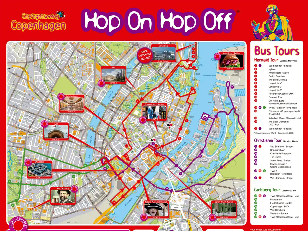
Getting Around with the Tourist Map
With Copenhagen’s excellent public transport network, your tourist map will be your best friend. Here’s how to traverse the city:
Public Transport Overview
The city boasts buses, a metro system, and trains, all accessible through the map, making travel seamless!
Key Transport Options
| Transport Type | Coverage | Frequency |
|---|---|---|
| Bus | City and suburbs | Every 10 min |
| Metro | Central city | Every 4 min |
| Train | Greater Copenhagen | Every 12 min |
Biking Around the City
Copenhagen is one of the most bike-friendly cities in the world! Many tourist maps also highlight bike rental locations.
Personal Experiences: Exploring Copenhagen
Every trip is filled with memorable encounters, and Copenhagen was no exception! Here are some personal highlights:
Unexpected Delights in Vesterbro
While venturing off the beaten path, I stumbled upon Vesterbro—a neighborhood brimming with vibrancy! The local cafés served the best coffee I’ve ever had, and the atmosphere was irresistibly relaxed.
A Culinary Journey in Torvehallerne
This food market was a gastronomic paradise. I tried traditional Danish smørrebrød (open sandwiches) and discovered local craft beers that were simply divine!
Travel Tips for Navigating Copenhagen
Here are some valuable tips to enhance your trip:
Stay Connected
Consider getting a local SIM card or using portable Wi-Fi for easy access to maps and information.
Timing Your Visit
Copenhagen is lovely year-round, but spring and summer offer the best weather. I visited in mid-June, and the long days were perfect for sightseeing!
Learn Basic Danish Phrases
Though most Danes speak excellent English, knowing a few basic phrases can enhance your experience.
Pros and Cons of Using a Tourist Map
Pros
- Easy navigation through the city.
- Helps discover hidden gems.
- Can include public transport info and trails.
Cons
- May not always be up-to-date with new attractions.
- Over-reliance can lead to missing spontaneous experiences.

Recommended Tourist Maps for Copenhagen
When it comes to choosing a tourist map, several options stand out. Here’s a comparison:
| Map | Rating | Key Features | Price |
|---|---|---|---|
| Copenhagen City Map (Lonely Planet) | 4.7/5 | Includes attractions, restaurants, and metro lines | $12.99 |
| Kort over København (by the Tourist Board) | 4.5/5 | Ideal for walking tours | Free |
| National Geographic Traveler Map | 4.6/5 | Durable and waterproof, includes detailed trails | $14.99 |
Where to Purchase
You can find these maps at local bookstores, tourism offices, and online retailers such as Amazon. Always check for the latest edition to ensure accuracy!
FAQs about the Tourist Map of Copenhagen
What are the best areas to visit in Copenhagen?
Key areas include Nyhavn, Christianshavn, Vesterbro, and Nørrebro. Each offers a unique flavor of Copenhagen’s culture.
Is it safe to walk around Copenhagen at night?
Yes, Copenhagen is one of the safest cities in Europe. However, always stay aware of your surroundings, especially in less crowded areas.
Can I use a digital map on my smartphone?
Absolutely! Many apps are available that provide interactive city maps and include transport links, making it easy to explore.